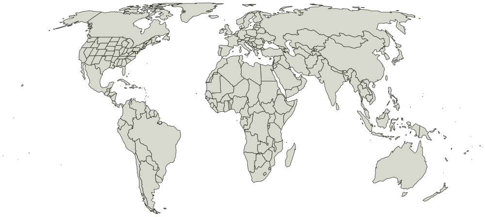
Blank map of the world with US states

All 232 countries + 51 US states, unlabeled and unfilled. The SVG prints at any size without going fuzzy and opens in any editor. It comes out wider than it is tall, so it prints sideways.
Boundaries from Natural Earth, public domain. You can use the outline for anything, including work you sell.
ArubaAfghanistanAngolaAnguillaAlaskaAlabamaAlbaniaÅlandAndorraArkansasUnited Arab EmiratesArgentinaArmeniaAmerican SamoaAshmore and Cartier Is.Antigua and Barb.AustraliaAustriaArizonaAzerbaijanBurundiBelgiumBeninBurkina FasoBangladeshBulgariaBahrainBahamasBosnia and Herz.St-BarthélemyBelarusBelizeBermudaBoliviaBrazilBarbadosBruneiBhutanBotswanaCaliforniaCentral African Rep.CanadaSwitzerlandChileChinaCôte d'IvoireCameroonColoradoDem. Rep. CongoCongoCook Is.ColombiaComorosCabo VerdeCosta RicaConnecticutCubaCuraçaoCayman Is.N. CyprusCyprusCzechiaDistrict of ColumbiaDelawareGermanyDjiboutiDominicaDenmarkDominican Rep.AlgeriaEcuadorEgyptEritreaSpainEstoniaEthiopiaFinlandFijiFloridaFalkland Is.FranceFaeroe Is.MicronesiaGeorgiaGabonUnited KingdomGeorgiaGuernseyGhanaGuineaGambiaGuinea-BissauEq. GuineaGreeceGrenadaGreenlandGuatemalaGuamGuyanaHawaiiHong KongHondurasCroatiaHaitiHungaryIowaIdahoIndonesiaIllinoisIsle of ManIndianaIndiaIndian Ocean Ter.IrelandIranIraqIcelandIsraelItalyJamaicaJerseyJordanJapanSiachen GlacierKazakhstanKenyaKyrgyzstanCambodiaKiribatiSt. Kitts and NevisSouth KoreaKosovoKansasKuwaitKentuckyLouisianaLaosLebanonLiberiaLibyaSaint LuciaLiechtensteinSri LankaLesothoLithuaniaLuxembourgLatviaMassachusettsMacaoSt-MartinMoroccoMonacoMarylandMoldovaMadagascarMaineMexicoMarshall Is.MichiganNorth MacedoniaMaliMaltaMyanmarMinnesotaMontenegroMongoliaN. Mariana Is.MissouriMozambiqueMauritaniaMississippiMontserratMontanaMalawiMalaysiaNamibiaNorth CarolinaNew CaledoniaNorth DakotaNebraskaNigerNorfolk IslandNigeriaNew HampshireNicaraguaNiueNew JerseyNetherlandsNew MexicoNorwayNepalNauruNevadaNew YorkNew ZealandOhioOklahomaOmanOregonPennsylvaniaPakistanPanamaPitcairn Is.PeruPhilippinesPalauPapua New GuineaPolandPuerto RicoNorth KoreaPortugalParaguayPalestineFr. PolynesiaQatarRhode IslandRomaniaRussiaRwandaW. SaharaSaudi ArabiaSouth CarolinaSouth DakotaSudanS. SudanSenegalSingaporeSolomon Is.Sierra LeoneEl SalvadorSan MarinoSomalilandSomaliaSt. Pierre and MiquelonSerbiaSão Tomé and PrincipeSurinameSlovakiaSloveniaSwedeneSwatiniSint MaartenSyriaTurks and Caicos Is.ChadTogoThailandTajikistanTurkmenistanTimor-LesteTennesseeTongaTrinidad and TobagoTunisiaTurkeyTuvaluTaiwanTexasTanzaniaUgandaUkraineUruguayUtahUzbekistanVirginiaVaticanSt. Vin. and Gren.VenezuelaBritish Virgin Is.U.S. Virgin Is.VietnamVermontVanuatuWashingtonWisconsinWallis and Futuna Is.SamoaWest VirginiaWyomingYemenSouth AfricaZambiaZimbabwe

What you are printing

Equal Earth, so areas are true and Greenland comes out about the size of Algeria rather than the size of Africa.

Every place is a separate shape, so a vector editor can select and fill one without touching the ones around it. Names are in the file as titles rather than as drawn text, which is what keeps the printed sheet blank.

Every place on it

The map page lists all 232 countries + 51 US states by name, and colors them in the browser if you would rather not print anything.